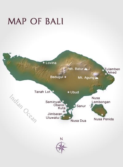
Bali Location
Exotic East Asia
The small island of Bali is part of the Republic of Indonesia. It spans 180 kms from east to west and 80 kms north to south, with a total area of 5,632 square kilometres. It lies only 8 to 9 degrees south of the Equator, between the islands of Java and Lombok.The island’s International Ngurah Rai Airport (DPS) is close to the capital of Denpasar in the island’s south, and is serviced by many major airlines.
| Flying Times to Bali, Indonesia | ||||
|---|---|---|---|---|
| City | Flying Time | City | Flying Time | |
| Jakarta | 1.5 hours | Sydney | 6 hours | |
| Singapore | 2 hours | Tokyo | 7.5 hours | |
| Hong Kong | 4.5 hours | London | 16 hours | |
| Perth | 3 hours | Los Angeles | 18.5 hours | |
Tidak ada komentar:
Posting Komentar